Aguas Tuertas e Ibón de Estanés desde Guarrinza
Track Description / Características de la Ruta:
Distance / Distancia: 18.80 km
Elevation Gain / Ascenso: 1.184 m
Max / Min Altitude: 1.898 m / 1.267 m
Difficulty / Dificultad: Middle / Moderada
Activity: Trekking / Senderismo
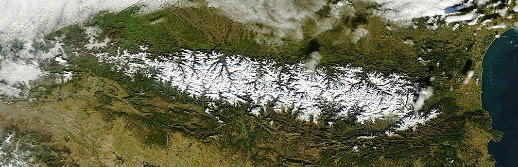
The Parque Natural de los Valles Occidentales comprehends the west valleys of the Pyrenees in the region of Aragon. Mountains in these valleys are below 3000m, letting the humid fronts coming from the North and Bay of Biscay discharge generous quantity of rain (and snow) all year round. Large extensions of forest as Selva de Oza create a unique habitat for the almost extincted brown bear in this part of the Pyrenees. As we gain altitude, the forest transform in big extensions of green grass where ships and cows graze during the summer. / El Parque Natural de los Valles Occidentales comprende los valles más occidentales del Pirineo Aragonés. Las montañas por esta zona están por debajo de los 3000m, dejando pasar los frentes húmedos del norte y del mar cantábrico que descargan gran cantidad de lluvia y nieve durante todo el año. Largas extensiones boscosas como la Selva de Oza crean un hábitat único para la casi extinguida población de Oso Pardo en esta parte del Pirineo. A medida que ganamos altura, el bosque deja paso a grandes extensiones de pastos.
Driving from Hecho, Huesca, we continue on road A-176 to Siresa. In Siresa the road ends, and surface of the road may not be in good shape, especially right after the winter. Nevertheless, it is usually possible to reach the last small parking lot at Lo Barcal with a normal sedan car after more than 10km of astonishing views. With snowy weather, however, or after heavy rains, the road might be closed or in bad shape for sedans. / Para llegar, conducimos desde Hecho, Huesca por la carretera A-176 dirección Siresa. Poco después de Siresa la carretera termina y la pista puede no estar en buen estado, especialmente después del invierno. A Pesar de todo, normalmente es posible llegar con un turismo normal hasta el último parking del Barranco de Lo Barcal tras 10km de pista forestal con unas vistas increíbles. Con nevadas, o después de fuertes lluvias, la carretera puede estar sin embargo en mal estado para vehículos normales.
This track describes one of the most popular treks in the Natural Park, the springs of the Aragón-Subordán river and Ibón (lake) de Estanés. The trek starts at the small parking lot located at the gully of Lo Barcal, almost at the end of Guarrinza Valley. / El track describe una de las excrusiones más famosas en el Parque Natural, el nacimiento del río Aragón-Subordán y el Ibón de Estanés. El paseo empieza en el pequeño aparcamiento situado en el barranco de Lo Barcal, casi al final del Valle de Guarrinza.

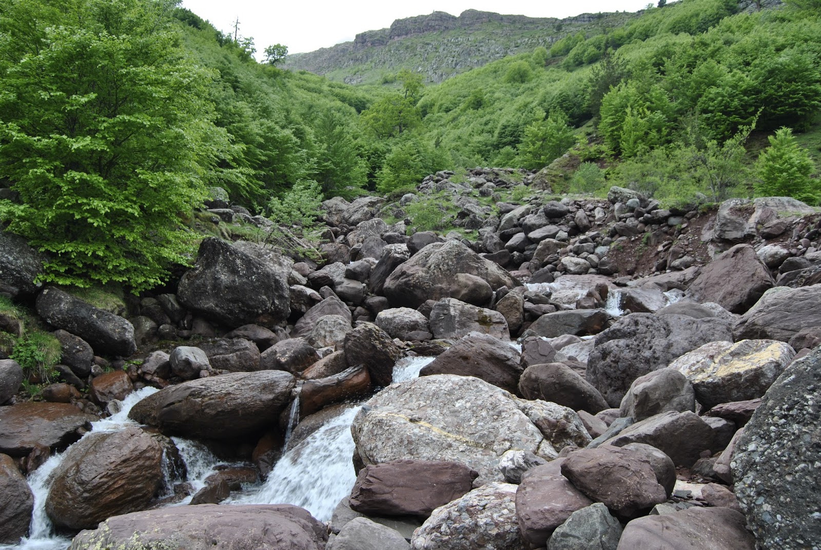
Once we have parked, we continue walking up the river using the path over the valley. After a few hundreds meters, we can get a glimpse of the Aragón Subordán water-falls bridging the gap between Aguas Tuertas and Guarrinza Valleys. I am not a geological expert, but the waterfalls seems to have been formed on an ancient glaciar moraine separating the upper and lower valleys. // Una vez aparcamos, continuamos andando por la pista que asciende paralela al río. Después de unos cuantos cientos de metros ya podemos vislumbrar las cascadas del Aragón Subordán, que salvan el desnivel entre los valles de Aguas Tuertas y Guarrinza. No entiendo mucho de geología pero parece como si las cascadas se forman en una antigua morrena glaciar que separa el valle superior (Aguas Tuertas) del inferior (Guarrinza).

 |
| Aragón Subordán waterfalls |
 |
| Guarrinza Valley / Valle de Guarrinza |
Once we ascend to Aguas Tuertas Valley, we find an open mountain hut which can be used as a shelter in case of bad weather. The entry to the Valley is amazing. We can appreciate a typical glacier U-Valley surrounded by peaks above 2000m. The Aragón Subordán river advances through the valley forming beautiful meanders. The bottom of the valley is usually a swampy covered by a green blanket of grass. The path goes up on the right hill sides of the valley. At the end of May, the summits of the surrounding peaks might still have snow which made it through the spring. // Una vez ascendemos al valle de Aguas Tuertas encontramos un pequeño refugio abierto que puede ser utilizado en caso de mal tiempo. La entrada al Valle es impresionante. Podemos apreciar el típico valle glaciar con forma de U, rodeado por picos de más de 2000m. El río Aragón Subordán se abre paso a través del valle formando curiosos meandros. El fondo del valle es típicamente una zona muy húmeda cubierta por un verde manto de hierba. El camino que recorre el valle va por la ladera derecha. A finales de Mayo puede ser posible que los picos que rodean el valle estén todavía cubiertos de nieve que aguantó la primavera.


On the hill sides of Punta del Huerto mountain (2062m) we can appreciate remainders of snow avalanches which reached the valley. Some big rocks where transported from above, and some others where literally pulled out the ground. // En las laderas de Punta del Huerto (2062m) podemos apreciar los restos de aludes de nieve que bajaron hasta el fondo del valle. Algunas rocas fueron transportadas desde arriba y algunas otras literalmente arrancadas de la tierra.

As we ascend to Puerto de Escalé (1663m), the river stream gets thinner, we are approaching the springs of the Aragón Subordán. The Puerto de Escalé was for many years one of the border pass, an ancient way of communication between the Spanish and French valleys of the Pyrenees. Once at the highest point on the mountain pass, we have again amazing views of all the valley. // A medida que ascendemos hacia el Puerto de Escalé (1663m) el río se hace más pequeño, estamos aproximandonos a las fuentes del Aragón Subordán. El Puerto de Escalé fue durante muchos años un importante paso de montaña entre los valles franceses y españoles. Una vez llegamos al punto más alto del puerto, las vistas del Valle de Aguas Tuertas son impresionantes.


As we gain altitude, the terrain becomes alpine, the snow appears, the open valleys dissappear. We are forced to walk up through a small path covered by snow. A few weeks ago, ice axe and crampons would have been compulsory from this point on, today we can negociate it without them being careful. // A medida que ganamos altura, el terreno se convierte en alpino, la nieve aparece, los abiertos valles se convierten en cerrados barrancos. El estrecho camino asciende ladeando la ladera cubierta de nieve. Hace unas semanas hubiera sido necesario el uso de crampones y piolets para salvar esta zona, hoy podemos hacerla con mucho cuidado sin ellos.


As we ascend, 10cm of fresh snow from the past night covers everything. A small mountain pass around 1925m altitude points out the way down to the Estanés lake. On a clear day, we could catch a sight of the lake from this point. Unfortunately, today the clouds from the French side cover the border mountains. // A medida que ascendemos 10 cm de nieve fresca de la noche anterior cubre todo. Un pequeño collado sobre la cota 1925 nos marca el camino de descenso hacia el Ibón de Estanés. En un día claro desde este punto podríamos ver el Ibón de Estanés, desafortunadamente hoy las nubes del lado francés se cuelan en los picos de la divisoria.

We descend, amongst the foggy weather, carefully walking on the snow until the shore of the lake. // Descendemos andando con cuidado por la nieve desde el collado en medio de la niebla, hasta llegar al Ibón.


On the way back, some clouds had dissipated and we got the chance to take brighter pictures of the Aguas Tuertas Valley. // En el camino de vuelta algunas de las nubes se disiparon y tuvimos la oportunidad de tomar fotos más luminosas del valle de Aguas Tuertas.


 |
| Entry to Aguas Tuertas valley / Entrada al Valle de Aguas Tuertas |
 |
| Guarrinza Valley |
 |
| Groundhog / Marmota |

 |
| Chipeta Alto y Sayéstico from Guarrinza Valley |
 |
| Peña Forca and Rincón de Alano |
- This is one of the most popular hikes in Parque Natural de los Valles Occidentales. Besides in winter time, when the snow covers most of the valley, the track is easy to follow, with limited technical difficulties. // Es una de las rutas más populares del Parque Natural de los Valles Occidentales del Pirineo. Fuera de la temporada invernal, cuando la nieve puede cubrir casi todo el valle, el track es fácil de seguir, sin a penas dificultades técnicas.
- We can extend the track coming back through the Puerta de Acher mountain pass, descending by the gully of Lo Barcal, on the hillsides of Castillo de Acher peak. Unfortunately, the foggy weather forced us to follow the same way back. // Otra posibilidad bastante interesante consiste en extender el track para volver por la Puerta de Acher y bajar por el Barranco de Lo Barcal, en las laderas del Castillo de Acher. Desafortunadamente, debido a la espesa niebla, nosotros decidimos volver por el mismo camino.
- On Aguas Tuertas Valley, we can find many megalithic monuments such as Dolmens. // En el Valle de Aguas Tuertas nos podemos encontrar con varios monumentos megalíticos como dólmenes.
- Depending on the season, the water level of gullies and Aragón Subordán river could make us difficult to cross the water streams. // Dependiendo de la estación, el nivel del agua de barrancos y del Aragón Subordán podrían ponernos un poco dificul cruzar los ríos en pasos determinados.
No hay comentarios:
Publicar un comentario